
Elk Creek Conservation Area
The Rundown
Spoon Rating:
3
Distance:
2-3 miles
Elevation Change:
Not Listed
Typical Surface:
Packed gravel, earth, rock
Typical Width:
4 ft
Nearest Town:
Forks, WA.
Cell Phone Reception:
Spotty at trailhead, no reception on trail except at the bench on the top of the hill (tested on Verizon).
Amenities:
Unlisted
Why go?
Elk Creek Conservation Area is my favorite hike in Forks, Washington. Owned by the North Olympic Land Trust, Elk Creek is a treasure of protected habitat. The 255-acre conservation area offers beautiful riparian forest, a soothing creek, and abundant plant and wildlife. If you are looking for a quiet place to be with the temperate rainforest of the Olympic Peninsula, Elk Creek would be a great choice. The trail also gets my vote for best interpretive signs, which entreat the hiker to experience the forest with many senses.
The Hike
The Trail of the Senses, as the trail through the Elk Creek area is called, is a “lollipop” trail. The trail goes out for 1 mile before crossing a 65-foot long footbridge and entering a 1-mile loop. If you complete the loop it is a 3-mile hike, if you opt to only go out and back it is 2-miles. The trail is a combination of packed gravel, earth and rocks, and is wide, but can be a little muddy in a few places. You’ll ascend a hill through changes of forested land, then descend into a truly magical creekside forest.
The trail begins at the gravel parking area with an interpretive sign and basic map of the trail.
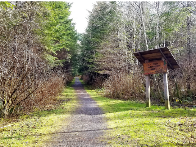
A gravel path leads past a wooden sign reading Elk Creek Conservation Area and into the woods.
Begin walking on the level gravel road through replanted forest, keep to the right at the first fork, then to the left at the grove of alder trees. Here you will go up a switchback and begin the elevation gain; the switchback is approximately ramp grade. You will then walk about 40 paces up the steepest grade of the trail (about 10%, I’d say) and reach the top of the hill. There is a bench here to rest and enjoy the transition to older forest.
You will then descend again about 20 paces and come to a boardwalk. This boardwalk is level with one step and the 44 planks are tightly placed, but it can be a little slippery. Descend another 20 paces on a slope with some erosion control fabric (I usually walk a bit sideways on this one for traction). You’ll then be at the creek in secluded forest.
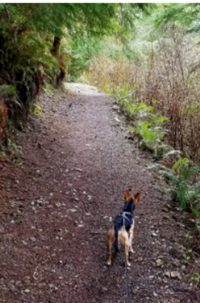
A somewhat steep section of dirt trail, with trees on the left and a hill descending on the right. A small dog looks ahead to the trail.
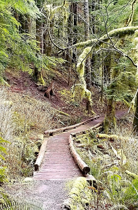
A boardwalk with round logs on either side crossing a stream channel.
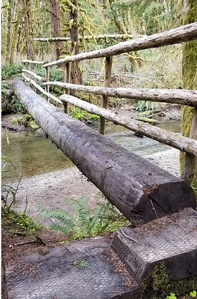
A footbridge spans the creek. Three steps lead up to the bridge with railing on one side.
Go left at the T and take a moment at The Sisters, two 200-year old Sitka Spruce. Continue walking through spruce, cedar, and hemlock, huge old stumps now nursing new growth, and look for one of the many places to go sit by the creek. Look for signs of salmon and trout, listen for the many birds, and perhaps you’ll even spot the elk that this creek is named for (though don’t get too close if you do). Also, be watchful for tree roots and rocks sticking up from the trail, there are a couple of places where you will need to step over them.
At the second visible creek bend you will come to a small hill; go to the left and then the second trail section up (the left path in this photo).
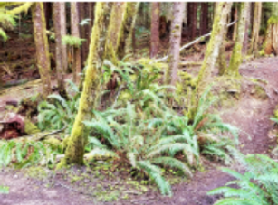
a small hill with a path forking around trees.
The other two sections are a little steeper and/or have more roots or other barriers, but they are passable. Next, you’ll come to a set of three steps, which are made of earth blocked up with roots and wood. Some traction control has been cut into the wood, and you step down either onto a slightly muddy area or onto a piece of wood over it.
Here the seasonal tributaries to the creek cut closely to the trail. Drainage work has been done and I frequently see people working on channels. There is one place where water seems to always cross the trail; depending upon rain levels it is a small flow of water easily stepped over, or it splits into several deeper flows and the area gets rather soggy. If you are especially concerned about muddy, soggy spots then I would avoid it in the heaviest of the rainy season, otherwise it shouldn’t be a problem.
The wetlands here are full of Western Skunk Cabbage, one of my favorite early signs of spring. Their bright yellow flowers rising from the swamp are a real joy, and the scent is certainly unmistakable.
Continue along the mostly level trail with the sounds of the creek to one side and hills rising on the other. There are some very interesting old growth stumps. There is one that I call the “spooky tree” and another that is my “forest troll friend” – let me know if you can guess which ones they are.
You will come to the place where a footbridge will take you across the creek and to the end loop of the trail. The footbridge is a cedar log cut smooth and is a bit narrow, with rough-hewn railing on one side and metal netting for traction. On your side will be a short ramp to walk onto the bridge, on the other are three steep, rough steps. The bridge sways and bounces a bit as you cross it.
Generally speaking, the trail on the other side is muddier than the rest. It also has several elevation changes and steep and slippery places. It loops through younger forest on the other side of the creek; it provides a couple of views from above and there is one place where you feel pretty secluded in the forest with the creek on either side. But to be honest, I wouldn’t say it is as remarkable as the rest of the trail, so if you don’t want to cross the bridge, don’t feel like you are missing out. Before you come to the bridge there is a sign for a horse ford, and this is a nice easy place to get down right on the gravel creek bed and explore a bit.
If you do cross the bridge, Follow the trail as it curves to the right, and then I recommend starting the loop from the right side. This will put you going uphill for the steepest slope, which is short but slippery and eroding through roots on the trail (it is easier for me to get traction going uphill but make the choice that is best for you).
There are a couple of short boardwalks, the first is one step up from round logs onto 21 unevenly spaced planks. As you reach the top of the loop and curve back to return, you will hear a tributary coming down from the hill that has folded you into the forest. Keep going and then you will come to the short, steep section; carefully make your way up and then back down, and you’ll return to the main trail to cross the bridge again.
If you need a rest on the way back before heading back up the hill, there is a lovely shelter with benches just past The Sisters on the left. Instead of turning right at the trail intersection, continue straight and follow the footpath to the shelter.
Finding the Trailhead
Public transportation option:
From the Forks Transit Center board the 17/Forks Shuttle. Get off at Calawah Way at Elk Corner Road, located at the beginning of the right curve. Continue walking 350 feet to the parking area and trailhead.
Getting There:
From downtown Forks, head north on Forks Ave / Hwy 101. Turn right on Calawah Way (at the emergency signal which may or may not be working). Continue on this two-lane paved residential road to a sharp left curve and then a right curve; be prepared to turn into the parking area. The small gravel parking area is on the right at the end of the curve. Pull in on the right side.
Nearby Alternatives:
For a short, level walk through the forest, try the Nature Trail at the Forks Visitor Center (guide published soon).
Land
Acknowledgement:
Elk Creek Conservation Area is on traditional Quileute Nation land.
